


2024-08-02_14h12m47_Lac_de_Sainte_Marguerite_et_les_sources_de_J_rusalem

jpb83
User
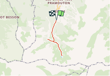

Length
9.2 km

Max alt
2231 m

Uphill gradient
599 m
Km-Effort
17.1 km

Min alt
1713 m

Downhill gradient
599 m
Boucle
Yes
Creation date :
2024-08-02 12:12:47.556
Updated on :
2024-08-07 11:39:57.566
3h53
Difficulty : Medium

FREE GPS app for hiking
 SityTrail
IGN / Geographical institutes
SityTrail Plus
The world is yours!
About
Trail Walking of 9.2 km to be discovered at Provence-Alpes-Côte d'Azur, Hautes-Alpes, Les Orres. This trail is proposed by jpb83.
Positioning
Country:
France
Region :
Provence-Alpes-Côte d'Azur
Department/Province :
Hautes-Alpes
Municipality :
Les Orres
Location:
Unknown
Start:(Dec)
Start:(UTM)
305404 ; 4928413 (32T) N.
Comments